")
The Wateranga Project is located 30 kilometres southeast of the township of Mt Perry and sits immediately beside the Burnett River nine kilometers upstream of the Paradise dam. The ‘Northern’ and ‘Central’ areas are located on the northern bank of the river within the Perry Shire whilst the ‘Southern’ project area on the southern side of the Burnett River lies in the Biggenden Shire. The area is well serviced by primary and secondary road systems, is only 40km to the west of National Highway 1 (Bruce Highway) and 80km west of the city of Bundaberg (Figure 1 & 2).
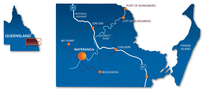
Figure 1. Project area shown relative to Queensland coastline
The exact location can be found using ‘Google Earth’ coordinates latitude 25° 19’ 17.27” S and longitude 151° 50’ 43.43” E.
The company maintains an 88kms2 EMP (#13278) within which a 1551Ha Mineral Development Lease (MDL355) has been granted.
The MDL and Mineral Lease Application areas are predominantly cleared pastoral and grazing land.
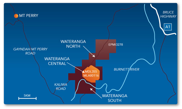
Figure 2. Detailed project area
The Project’s proximity to readily available water, power, rail line and infrastructure place it in an excellent position to competitively produce a variety of industrial mineral products, with economic benefits afforded to the local community and State of Queensland.
Water resources:
The Wateranga Project sits immediately beside the Burnett River nine kilometers upstream of the Paradise dam. This unique natural advantage provides abundant easy accessible water resources for the project especially for process plant usage.
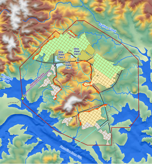
Figure 3. Unique natural advantage of easy accessible water resources
Power:
Besides solar power, a KMS-1000KW Diesel Generator Set will be our power alternative before the goverment’s power line stretched into our sites later on. Based on previous study by HTL , diesel generator is preferable for mining stage 1 as it is more cost effective.
HTL has started application process for HV power, and hopefully it will be connected to site within two years.
Road Access:
A professional transpiration report has been done to select the best road access from mine site to Port Bundaberg. The preferred route selection has been undertaken based on distance, speed environment and any other considerations which may impact on or be impacted by the movement of heavy vehicles. According to this report, currently the most economical route is travelling south from site to Port Bundaberg via Gooroolba, Biggenden, and Booyal by 19 meters B-double trucks.
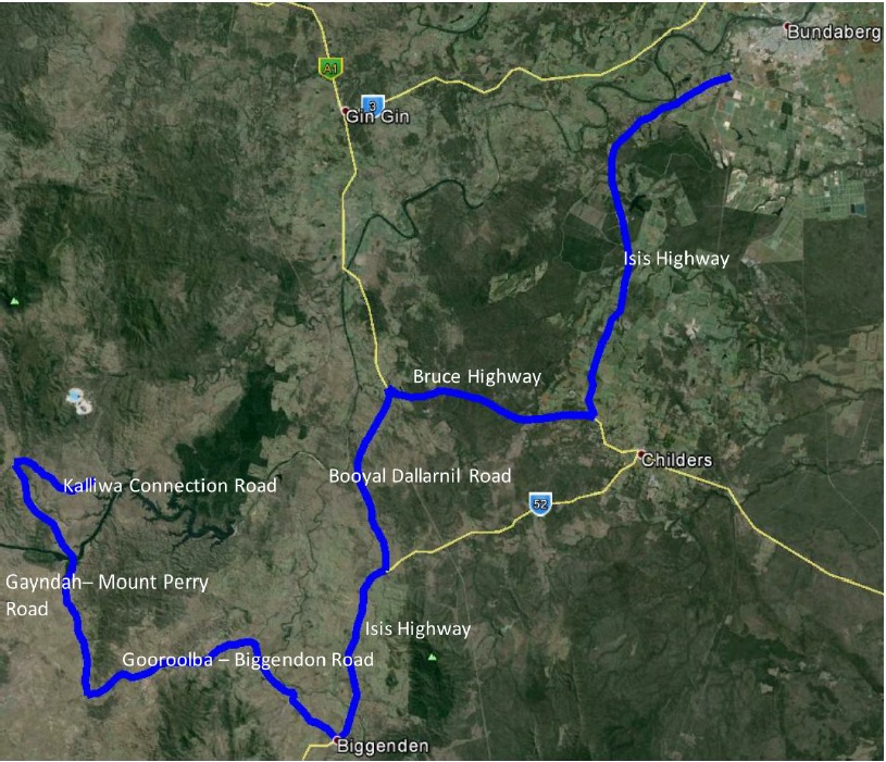
Figure 4. Recommended regional haulage route (Southern route)
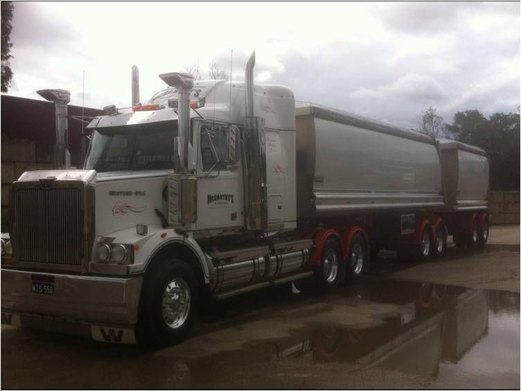
Figure 5. 19 meters B-double truck
Meanwhile HTL is continually working on the possible shortcut route pass by Good Night Scrub National Park to further bring down haulage cost.
Port Access & Facilities:
Memorandum of Understanding (MoU) has been executed with Gladstone Ports Corporation Limited and Queensland Sugar Limited (Port facilities owner). Based on the MoU, an area of 15,000m2 land has been allocated to HTL at Port Bundaberg for stockpiling and further development. HTL has started working with Port Bundaberg to settle products stock pile, loading and shipment for mineral sands exports.
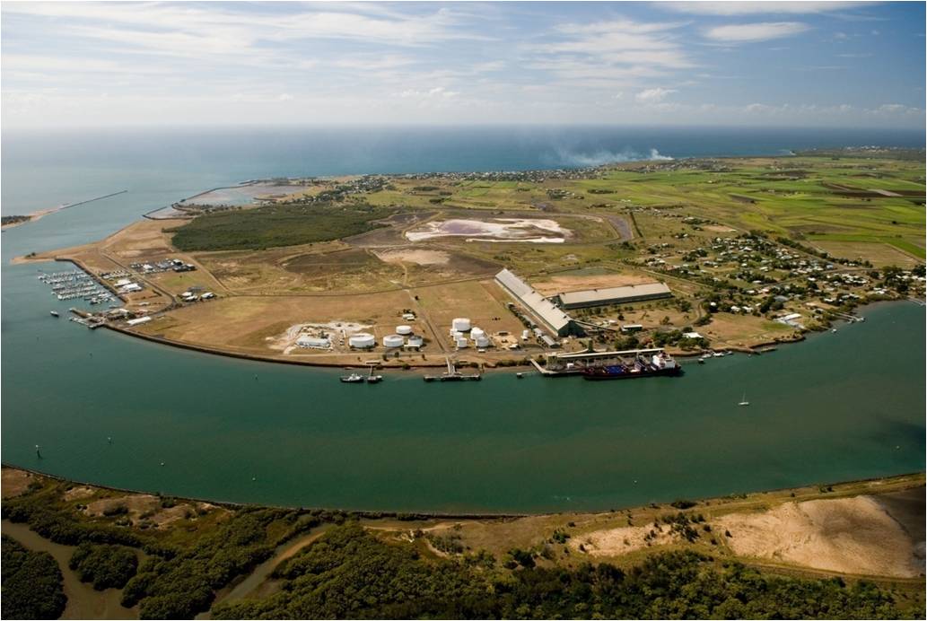
Figure 6. Port Bundaberg